From a pick-up point in Nagcarlan, we will proceed to the Assembly area for Registration and brief Orientation. Upon dropping-by, it will be our recommended stop for last minute check of our packs, food provision and hydration.
On to the Basecamp
We then start the hike at "Talaytayin" jumpoff. And as soon as we heads up on its sandy-volcanic foot
trails and stride into its lush greeneries, a welcoming nature treat endemic
to the area awaits to everyone's delight. Desirable Raspberries or as
locals call it “Sampinit” are prevalent along it's eco-trails. Appealing and engaging, we can not ignore these little treasures in vibrant red color invitingly exposed within the
rich surrounding foliage. We can pick and try some as we wish and amuse ourselves of its sweet-soury freshness. Best of all....its' FREE!!!
 |
| lush greeneries and densed vegetation |
 |
| truly inviting wild raspberries ("sampinit") along the trails |
Morning hike is recommended
though to experience these abundant fresh treats while heading uphill.
While passing along its prairies,
inhabitants farming their respective pastures greet us with their timid smiles
but friendly enough to warmly respond if we briefly converse with them pleasingly.
Arriving at “Sayimsim pass” will
showcase the magnificence of its surrounding indescribable to words. And just
as reaching the elevated portion of the pass we can clearly see the sheer size of “Sumandal Foothill” up front. Several meters to our right is the trailhead to the Strawberry Farm that needs no
further introduction.
As we heads up and continue hiking passing the strawberry farm, just a stone throw away is a crater they call "Kakawa". With a diameter of around 2 hectares, "Kakawa crater" became a pasture land of local inhabitants.
The crater evidently is a clear substantiation of a volcanic landform of Mt. Banahaw and Mt. San Cristobal both of whom are active volcanoes hundred of years ago.
As we continue hiking
further heading to the Basecamp, to our immediate left are the green meadows of "Gudya" with equally astounding attraction to offer. Standing on its ground already at around 647 masl on several
viewpoints we can see the seven (7) lakes
of San Pablo City and the entire municipalities of Rizal, Nagcarlan, Liliw and Majayjay.
 |
| "Sayimsim Pass" |
 |
| "Sayimsim Pass" |
Reaching “La
Presa de Kakawa” Basecamp at 653 masl, we will be greeted by farmer residents and its accommodating owner nanay
“Tonya”. Youngsters also call her mommy “Tonette”.
While waiting for everyone to arrive, we will take some short
time to catch our breaths and pull through to regroup while we ready ourselves
for the final leg of our ascend…the assault to Angel Peaks.
 |
| "pick and eat" treats at the Strawberry farm |
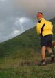
The assault to Angel Peaks
Peak 1 @820 masl
Recommended for average hikers
with good fitness level but not for the faint-hearted. It is a one hour (1) hike in moderate pacing to reach Peak 1 with 30-45 degrees slopes.
Upon getting into its peak you can see the seven (7) lakes of San Pablo city, the entire municipalities of Rizal, Nagcarlan, Liliw and Majayjay and the wholeness of Laguna Lake, its adjacent neighbor provinces: Rizal’s Sierra Madre mountain range, some parts of the Metropolis Manila , Cavite and Batangas mountain ranges.
Descending is a little faster though. For safety purposes all are reminded to take extra caution while going down the trails.
 |
| assault to Angel Peak 1 from where you can see the Basecamp on the upper right side of the picture |
 |
| on top of Peak 1 |
Peak 2 @994 masl
For experienced hikers with above
average fitness level and strictly not for
the faint-hearted. An estimated one hour and forty five minutes hike (1 hr 45 min) in moderate
pacing with 30-65 degrees slopes is most likely needed to reach Peak 2. Going down maybe a little faster but for safety purposes, all are reminded to take extra caution on descend.
 |
| Group picture at Peak 2 |
 |
| the local guide team |
Peak 3 @1,270 masl
For seasoned hikers in best
fitness level and strictly not for the faint-hearted. An estimated two hours and forty five minutes hike (2 hrs 45 min) in moderate pacing with 30-65 degrees slopes further is most likely required to reach Peak 3. Be aware of the poisonous "laygins" that might touch your skin along the trails. A brief dash will surely shock-surprise you of its aggravating pain that lasts for days if not treated well. Descending may take shorter time than ascending though for safety purposes, all are being reminded to take extra caution while going down.
 |
| stunning flora on the trails |
 |
| beautiful yet poisonous |
 |
| wilderness trail to Peak 3 |
 |
| @ 1,270 masl Peak 3 |
Some Reminders for everyone
All are advised to backtrack at a particular time instructed by the mountain guides. Camping is not permitted in any
of its Angel Peak.
Everyone should be
conscious of time when setting to ascend Angel Peaks most particularly Peaks 2 and
3. Weather should also be considered prior to proceeding.
All overnighters are encouraged to camp at “La Presa de Kakawa Basecamp”.
 |
| enjoy the moment "La Presa de Kakawa" |
 |
| site map |
All pictures compliments of AHON
Anakalang Hikers of Nature


No comments:
Post a Comment